Tuesday, October 02, 2012

The Trip Home - Pompey's Pillar Inspiration

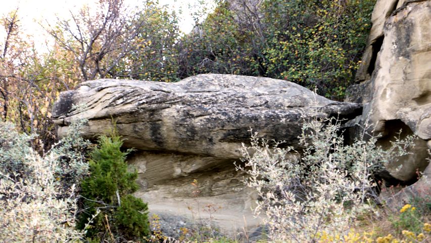
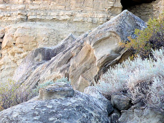
So here are my artsy shots of Pompey's Pillar and surrounding area, shapes and angles and textures that caught my attention. I have no idea how I can work them into an interesting piece of art, but like a sponge, I soak up images hoping some part of them squeeze out later.


In this and the top picture, you can see exposed different strata, smooth and not - how often do you think about what's under your feet, that there are layers there?


Bulges and cracks.


Shapes, curves, depressions.


I see at least one face in profile. Do you?


I also see a head on the left end of this large rock - it looks like an animal to me, maybe the mountain lion the Indians referred to.


At first I thought this was a log with bark still intact but on closer inspection it was definitely a rock.


More curves and shapes.


I have always had a fascination with tilted rock formations. I grew up in an area that was all tilted layers created by the formation of the mountains. Whenever I see this sort of thing, I want to take a picture.


There's that guy again. It reminded me of the logo of Fat Harvey's Truck Stop in Oregon.


And now the trees. Towering overhead.


The texture of the bark was oversized - I took the pic on the left to give point of reference. Big trunks, very tall, very craggy bark.


And yes, I like my curves.


But I like parallel lines too. This replica of a dugout canoe has design potential.


Once again, I'd done my sightseeing late in the day, so it was time to head for the motel in Billings. This Day's Inn was challenging to get to, as it was inexplicably located in an industrial part of town but it was one of the nicer motels I stayed in. Not a lot of outer ambiance but the rooms and Continental breakfast and spa were first rate.

Monday, October 01, 2012

The Trip Home - Pompey's Pillar

Back in Junior High, I read a version of the Lewis & Clark Journals for a report - totally enthralled with the story of their expedition in the early 1800's into territory that was mostly unknown save for the trappers and fur traders who had ventured into the lands west of the Missouri River. As my dad took us on weekend trips around Idaho and Montana, we often saw historic signs indicating we were on the same path taken by Lewis and Clark. I'd always wanted to see Pompey's Pillar, named after Shoshone Indian guide Sacajawea's baby boy, but for some reason, our family trips never took us there. But I could go see it now since I was passing so near to the spot and had the time.


I feared that I had envisioned a more impressive formation than actually existed, and I was right to fear that. At first sight, I was disappointed with what looked like just a bluff jutting out. It was hard to envision why Lewis & Clark as well as the travelers that followed were so impressed with this. I chalked it up partially to having just seen the Badlands.

Looking SW from top of Pompey's Pillar

Looking more west out over the Yellowstone River

Looking NE from top of Pompey's Pillar
According to the journals, Clark climbed to the top of this pillar to survey the countryside. As part of the National Park System, modern visitors can climb stairs and boardwalks to gain the same view. That's the Yellowstone River which the party had traveled on.


In fact, back in Lewis & Clark's time, the Yellowstone flowed closer to the pillar. In the interpretive center, I found an early picture of the site from the mid-1800's and I was surprised that there were no trees surrounding it as there are today. That would definitely make a difference as to how impressive it might look from a distance, how it would stand out on the plain. This shot is taken on the "back side" between the river (behind me) and the pillar.


And a shot of the Yellowstone River where it passes near the pillar.


So you really can walk all the way around the pillar. This shot is looking more or less east back towards the Interstate. Clark said he could see ample herds of buffalo and other game on those plains. I'm still whining about how essentially flat everything is.


So I stood at the base of Pompey's Pillar and let it impress me for what it was - a really huge sandstone outcropping that humans have been visiting for one reason or another for centuries. Native Americans called it "the place where the mountain lion lies" - perhaps because they thought it resembled the head of a mountain lion (I'm not the only one with a vivid imagination).  They had been drawing petroglyphs on it long before white travelers started carving their names in it. Most of those names were carved along a section on the right of this picture - in the larger version look for poles that indicate the platform for viewing these.


But near the base on the front of the pillar I spotted this, which may be some of those older petroglyphs. I mused that when ancient people "tag" rock formations, they are held in reverence and awe. When more modern man does similar things, we think of it as defacing nature and vandalism. Granted, not much artistic about carving your initials in rock...


The birds make good use of the upper reaches of the outcropping, mudding in their nests.


But for most of the visitors, it is the old signatures carved into the pillar that is the main draw. The most famous is sealed behind a protective barrier. Some belong to the Lewis & Clark Expedition members, others are later - pioneers moving west by wagon train, trappers and traders, more modern tourists.


Yes, I was interested in those signatures, but I was also interested in the rock formations themselves, and of course, the trees. Yes, I took lots of pictures, some of which I'll share in the next post. Inspiration abounds!   


Sunday, September 30, 2012

The Trip Home - Wyoming into Montana

Interstate 90 cuts through a corner of Wyoming that is rugged high plains. If you look hard, you can see a slightly darker blue above the mountains on the left side of the picture. That's actually the Big Horn Mountain range, nearly obscured by smokey haze.


I'd noticed these on the way out - now I knew they were kin to what I saw in the Badlands.


I made a rest stop in Sheridan - it has a visitor's center up on a hill overlooking the freeway with picnic tables, a playground and a place to let out your horses. That's Wyoming for you. Yes, it really was that hazy.


While I was eating my lunch, I started seeing rabbits hopping all over the grounds. Yes, that's Wyoming for you too.


The rest area made ample use of the red rock I was seeing all through this area.


Back on the road headed towards Montana, things still looked plenty parched. That's why I was so surprised to spot this intense blue lake nestled among the pale yellow grass - a color palette I want to try.


All along the way there had been subtle reminders that it was indeed late September. Hard for me to get my head around. These became more pronounced as I got into Montana.


As I neared Billings, I backtracked a bit up Interstate 94 in order to visit Pompey's Pillar which will get its own blog post. I have to admit it was mighty unsettling to start seeing mileage signs for points east, but I only had to head that way about 30 miles, then it would be back to my westward trek.

Saturday, September 29, 2012

The Trip Home - Rest of South Dakota

After finally pulling myself away from the lure of the Badlands, I continued down the Interstate toward the Black Hills - a welcomed sight. I wanted to take another sidetrip up into those "hills" - mountains really - even though I was losing light. Not only did I need a mountain fix, I wanted to see Lead where my dad had worked before moving out to Idaho.


I turned off at Sturgis (Harley motorcycle enthusiasts rally here each August) and almost immediately entered a narrow forested canyon, the road winding its way up toward the infamous town of Deadwood. That canyon was just like my Idaho ones so I was so glad I'd headed up into them, waning light or not. Up over a little pass and then you drop into Deadwood. Unfortunately  I had no time to walk around in the older section of town - some wonderful architecture there. But I did feel so at home - these mining towns in these narrow canyons all have a certain look and feel, whether they are in South Dakota, Idaho or British Columbia.


After many twists and turns through this very strung out town, I came to Lead and its banner announcing "Home of the Famous Homestake Mine!" Yes, that was what I was looking for! I had heard stories about how my dad worked at that mine not long after he and mom got married - the deepest mine of its kind in the western hemisphere. It always sounded to me like there was a special cache to having endured those deep levels of underground gold mining. The family story continues that when World War II broke out, dad was not drafted because miners were deemed more valuable as miners than soldiers. However, it was not gold that the War Production Board wanted so the Homestake's operations were suspended and dad was transferred to a  mine near Wallace, Idaho, one that produced silver, lead and other minerals.  I can't believe that of all the sightseeing we did on family trips back to the area, dad never took me up to Lead.  Again, I really didn't have time to walk around much, but it was worth it to see the general area and some of the buildings still standing (the mine ceased operations in 2002). It's quite the scenic area.


I still had some miles to go to reach my destination for the night, and it led me over another pass (over 6000 ft) and winding down again through more narrow canyons with exposed rock outcroppings. I rued the lateness of the hour, not long before it was pitch black. And then I crossed over into Wyoming and headed north for Sundance and the Rodeway Inn. You gotta wonder about a place that feels it is necessary to advertise "clean rooms." And that pool & hot tub? "Discontinued" for the season along with their advertised continental breakfast. Hadn't really thought about the fact that I might be traveling "off season" and was pretty disappointed with the accommodations overall. At least they had good internet connections.


The stay in Sundance was not all bad. The next morning as I gassed up the car, I spotted this wonderful church spire.


And how about this - it was an Episcopal church - Good Shepherd. I would have loved to have attended a service there.